
Worcester Neighbors: Block Sources
A block question works best when each source is used for its own job. The city map describes how parcels meet roads and one another. The assessment record supplies a current owner-of-record lead, while plans and deeds describe land instruments. Historic street sections and maps can explain an earlier number sequence. Worcester neighbors can include owners, family members, and people with no public record tied to the parcel, so none of these sources should be treated as a household roster.
| Block source | Useful block detail | Access channel |
|---|---|---|
| Worcester Atlas | Parcel geometry, adjoining lots, roads, and visible public map layers | Public interactive viewer |
| Worcester Assessing | MBL, situs address, and an owner-of-record lead | Online search, certified inquiry by counter or mail |
| Registry plans and deeds | Lot lines, plan references, instruments, and transfer parties | MassLandRecords images and Registry assistance |
| Historic street directories | Published street order, businesses, and past address context | WPL, WHM, and selected digital scans |
| Ward and precinct records | Civic boundary and public local-voter-file rules | Elections office, map, or narrow local-file request |
Start with the smallest record that answers the question. A parcel card can identify the lot but cannot prove who occupies it. A deed names transfer parties, not a list of current residents. A historic directory is a publication for its year, not a certified record. For records that are not posted, the City Records Access Officer is the formal route under the Massachusetts Public Records Law, but exemptions and redactions still apply.
Worcester Atlas and Adjacent Parcels
The Worcester Atlas parcel and map-layer viewer is the right first stop once an address is normalized. Select the subject parcel, then look at the lots that touch it or face it across the street. Record the MBL, the printed situs address, road names, the visible parcel outlines, and any map date or legend. The Atlas is dynamic, so its available layers and popup fields can change. Use what the current screen actually displays rather than assuming a field is always present.
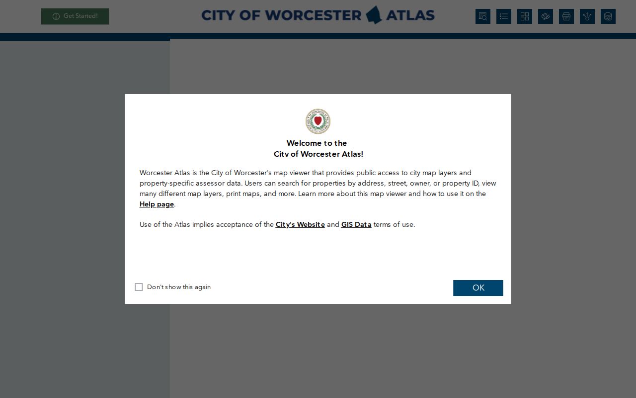
Parcel outlines make corner lots, rear lots, split parcels, and facing addresses easier to notice. They do not identify everyone connected to a block, and an owner mailing address may be somewhere else. Keep the map as geographic evidence, then consult the custodian that holds the record needed for the next question.
Worcester Neighbors: Address-to-Block Flow
Use one address as a starting point, not as permission to assemble a personal dossier. The sequence below preserves the distinction between a parcel, an ownership record, a deed, and a public civic boundary. It also catches blocks that change street names at a corner or include a rear lot with no obvious street number.
- Normalize the address, search Worcester Assessing by street, and record the MBL and situs label rather than copying a complete owner profile.
- Open the Atlas, select the parcel, and mark adjoining and facing outlines, road names, map scale, and the public layers visible that day.
- Use the Registry property or plan search to distinguish a deed from a mortgage, easement, plan, or other instrument before drawing a conclusion about a lot.
- Check Permit History by MBL or street only for public permit categories. The city labels it an inquiry, not a legal document or proof of occupancy.
- For a historical comparison, read the street section of a directory and then use Sanborn maps, WPL, WHM, or Clark map resources to compare the block form.
This process stays focused on the immediate block. When the question becomes a complete named-street record trail, the Worcester streets reference follows the longer assessor, Registry, permit, and historic-directory chain.
Worcester Neighbors Beyond Street Fronts
Street number order alone can mislead. A block may include a corner address using the cross street, a rear parcel, a business address, or land that was later split or combined. Worcester’s plan records can supply lot boundaries, easements, subdivision context, and references that the street view does not show. If a modern number is absent from an older source, compare nearby numbers, the historic street spelling, lot descriptions, and a map before deciding the record is unrelated.
The City Assessor is a current assessment source, while the Worcester Registry of Deeds keeps the recorded land trail. The Registry’s online records reach back to 1731, but the pre-1960 search commonly begins in scanned grantor and grantee index books. That older method is a useful local quirk: a modern address search may fail even where an earlier instrument exists. Read the document type and party role, then check probate or maps when an estate, subdivision, or plan changes the apparent chain.
Note: A mortgage or release can appear between deeds and does not by itself show a change in ownership.
Worcester Neighbors in Historic Street Records
For an earlier block, the street section of a Worcester directory can show the published number sequence, businesses, institutions, and names associated with a particular year. The Worcester Historical Museum holds city and street directories, with selected scans and examples beginning in 1829. Worcester Public Library also keeps city directories and local-history databases alongside census, newspaper, obituary, and Sanborn resources. Read neighboring lines on both sides of the street, but label them as directory entries, not confirmed present-day residents.
A directory and a map answer different questions. A directory captures a publisher’s annual listing, while Sanborn sheets and other historic maps can show the building footprint, street form, land use, and address labels. WHM, WPL, and Clark University’s Guy Burnham Map and Aerial Photography Library are the appropriate places for historical context, rather than a current parcel counter. Pair the publication year with the map date and retain the source wording when an older street name differs from the current one.
Worcester Civic Contacts by Area
Community context is better sought from public civic channels than from lists of private people. Worcester’s official materials use multiple geographic layers: council descriptions name areas such as Greendale, Burncoat, Indian Lake, Tatnuck, West Tatnuck, Newton Square, and Webster Square, while ward and precinct maps describe election geography. The labels can overlap without sharing the same boundary.
| Official contact route | Block-level use | Where to start |
|---|---|---|
| Police Neighborhood Response Team | Neighborhood meetings, assigned-officer connection, and community partnerships | Worcester NRT |
| City Council | District descriptions and councilor contact paths for locally named areas | Worcester councilors |
| Worcester Now | Next | Citywide planning context across dozens of neighborhoods | Worcester Now | Next |
| City Elections | Ward and precinct assignment, rather than a neighborhood identity | Your Vote Counts |
Use these routes to understand a public meeting, council district, or election boundary. They do not establish that each person in a named area belongs to an association or shares a common neighborhood identity.
Worcester Neighbors: Official or Compiled
Official records and commercial compiled tools serve different purposes. The first group can be checked against the office that created it and usually has a stated scope. The second may combine older or mismatched entries, so it should never replace an official source or a careful date check. The state-held property search shown below is another category entirely: it is for unclaimed property, not a record of who lives around an address.
Open the Massachusetts Find Mass Money search only for a properly scoped unclaimed-property question. It uses a name and optional city context, and a claim may require proof. It does not identify Worcester neighbors, establish an address, or link a person to an adjacent parcel.
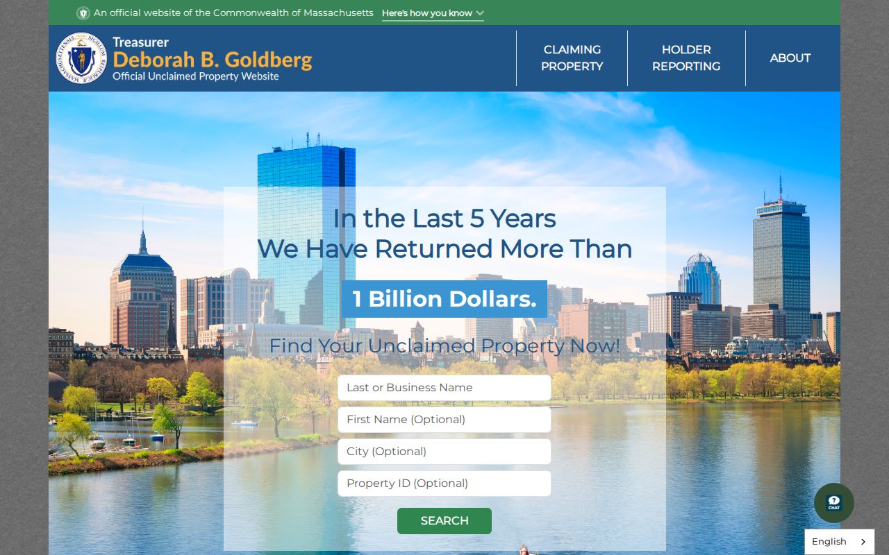
The official portal illustrates why record categories should remain separate. A public parcel map, a Registry deed, a city directory, and an unclaimed-property claim each have a different custodian, field set, and meaning.
| Source category | Best use | Important limit |
|---|---|---|
| Official map, assessment, deed, or directory source | Check one documented field against its original custodian | May show a parcel, transfer, or dated listing rather than current occupancy |
| Commercial compiled neighbor tool | At most, a prompt to verify a fact with the original office | May be stale, mismatched, incomplete, or unclear about its coverage |
Worcester ZIP Myth: A Block Is Not a ZIP
A ZIP code is postal delivery geography, not a legal neighborhood boundary or proof that a person is at an address. MassGIS notes that USPS does not maintain an official ZIP-boundary map, and USPS itself warns that an address result does not confirm a person or business there. A single Worcester block can also sit close to a different ward, precinct, parcel line, or council-area label.
Use the postal result to standardize an address, the Atlas for parcel geometry, and the ward or precinct map for civic geography. The city’s labels can be useful context, but a name such as Greendale or Main Street/Webster Square should be recorded as the city uses it, with its source and date. That approach is more accurate than turning a ZIP or civic label into a list of neighbors.
Note: The nearby 01611 and 01612 postal references point to Cherry Valley and Paxton in state material, not Worcester city.
Worcester Neighbor Lookup Privacy Limits
Massachusetts protections are tied to particular records and fields, not a universal public deletion rule. Confidential voter records are excluded from public lists. The Address Confidentiality Program, authorized by M.G.L. c.9A and 950 CMR 130, supplies an eligible participant with a substitute address, while the actual address is protected in court practice. Court impoundment, protected health-license information, sealed material, and restricted identity fields also limit what can be disclosed.
A local voter file may be requested through Worcester Elections for a narrow public purpose, but it is not a public neighbors-by-block roster. Public-field rules and production costs apply, while confidential voters and protected information must be withheld. Do not publish dates of birth, voter IDs, private contact details, an actual ACP address, or an unredacted protected court address. If a record is wrong, contact the responsible custodian, such as Elections, Assessing, the Registry, or the City Records Access Officer.
Lawful use. Use Worcester neighbor sources for a limited, lawful community or historical question. Do not use any record to watch, harass, intimidate, or harm another person, and do not try to defeat confidentiality protections.