
Worcester ZIP Code Coverage
State reference tables associate a number of 016xx ZIP codes with Worcester, but the entries do not create official neighborhood lines or a complete post-office assignment table. The labels below preserve the limits in the source material: they indicate Worcester mailing or geographic context, not a promise that every address in a named area receives that code. USPS is the source for a live delivery answer, while city and parcel systems answer separate municipal questions.
| ZIP Code | Areas Covered | Post Office | Notes |
|---|---|---|---|
| 01601 | Worcester mailing area | Verify by address | Commonly a PO Box context. |
| 01602 | West-side/general delivery area | Verify by address | Use USPS for standardization. |
| 01603 | South and Webster Square area | Verify by address | Boundary needs address-level confirmation. |
| 01604 | East and southeast area | Verify by address | Service type is not fixed here. |
| 01605 | North-central area | Verify by address | Confirm the live delivery result. |
| 01606 | Greendale/north Worcester area | Verify by address | Postal and civic layers differ. |
| 01607 | Quinsigamond Village/south area | Verify by address | Confirm service type. |
| 01608 | Central/downtown mailing area | Verify by address | Downtown can include PO Box use. |
| 01609 | Institutional/central area | Verify by address | Do not infer a service type. |
| 01610 | Main South/south-central area | Verify by address | Check precinct separately. |
| 01611 | Cherry Valley, not Worcester city | Verify by address | Do not assign it to Worcester without city confirmation. |
| 01612 | Paxton, not Worcester city | Verify by address | Nearby postal geography is not city geography. |
| 01613 | Worcester PO Box reference | USPS lookup required | Do not treat as standard delivery. |
| 01614 | Worcester PO Box reference | USPS lookup required | Do not treat as standard delivery. |
| 01615 | Worcester reference reported in compilations | Not confirmed | Official current use was not located. |
| 01653 | Worcester unique/corporate mailing reference | USPS lookup required | Service type requires a live result. |
| 01655 | Worcester official-state-table reference | USPS lookup required | Exact service assignment was not located. |
01611 and 01612 are the useful local contrast. State material identifies them with Cherry Valley and Paxton, not Worcester city. That difference matters when a search is meant to reach a municipal custodian, a Worcester parcel, or a Worcester ward. A postal city name is not enough on its own.
Worcester USPS ZIP Fields
USPS ZIP Code Lookup is the first stop for normalizing a current Worcester address. Its three routes are By Address, By City & State, and Cities by ZIP Code. The address route is not a resident search. USPS expressly cautions that its output does not confirm a person or company at the address. It standardizes delivery information, which is the useful starting point before checking a parcel or civic map.
| Field label | Type | Required | Format or purpose |
|---|---|---|---|
| Company | Text | No | Optional address addressee field. |
| Street | Text | Yes | Street address for the delivery check. |
| Apt | Text | No | Optional unit detail. |
| City | Text | Yes | Postal city used with the address. |
| State | Select/text | Yes | Massachusetts for a Worcester address. |
| ZIP | Text | No | Optional check against a known delivery code. |
The USPS result supplies a standardized mailing result. It does not settle the municipal city, parcel edge, owner record, ward, or precinct. Keep the returned wording with the date of the check, particularly for a PO Box or unique delivery result.
The USPS ZIP Code Lookup screen is useful for seeing the fields before entering an address.
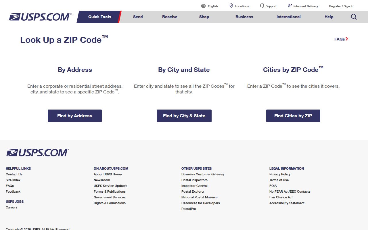
Its form separates a delivery-address check from the City & State and Cities by ZIP Code routes, which prevents a postal lookup from being mistaken for a person search.
Worcester 016xx Delivery Roles
Worcester's 016xx sequence contains different kinds of delivery references. Some entries are described as general delivery areas, while 01601, 01613, and 01614 have PO Box context in the research. The source also flags 01653 as a unique or corporate mailing reference. These are reasons to verify a complete address in USPS rather than applying a broad code to every location with a Worcester name.
01615, 01653, and 01655 illustrate another limit. The research found a Worcester reference but did not find a current official table that settles every post-office or service-type detail. Leaving that uncertainty visible is more accurate than filling a table from an unofficial ZIP list. Note: USPS supplies the delivery result, while a city office supplies the municipal answer.
Find Worcester ZIP Code Records
A ZIP code narrows an address question, but Worcester's local portals do not work as one ZIP-wide resident roll. The Assessor accepts MBL, street name, and owner name, not a ZIP input. The Registry has property and town modes, while the live behavior of its ZIP handling is dynamic. Elections organizes civic information by ward and precinct. The practical method moves from a postal result to the record system that keeps the needed fact.
- Use USPS with the full address and save the standardized city, state, and ZIP result.
- Search the Worcester Property Records page by street name or MBL to confirm the city parcel label.
- Open the parcel in the Worcester Atlas and compare its geography with the address.
- Use the city ward/precinct map or Elections Office when the question is civic geography, not postal delivery.
- Take the now-normalized street to the appropriate custodian. The Worcester street directory handles the fuller street-by-street record trail.
For a public local voter-file question, Worcester Elections can provide a local list subject to statutory exclusions. A request should be limited to the ward, precinct, street segment, date range, and public fields needed. ZIP is not the same layer as a precinct and should not be used to infer a polling assignment or a current occupant.
Worcester ZIP Sources Compared
Three official tools can describe the same Worcester place without giving the same kind of answer. Their difference is useful. USPS supplies delivery standardization; MassGIS represents approximate ZIP geography; city property and map tools describe parcels. A sensible ZIP code directory keeps those answers separate instead of choosing one as the universal boundary.
| Source | Best question | What it cannot settle |
|---|---|---|
| USPS lookup | What ZIP is returned for this delivery address? | City jurisdiction, parcel edge, or who is there. |
| MassGIS ZIP polygons | How does approximate delivery geography compare spatially? | An official USPS boundary or an exact delivery assignment. |
| Assessor and Atlas | What municipal parcel and mapped city geography apply? | Postal route or delivery status. |
| Ward/precinct map | What election geography applies? | ZIP or neighborhood boundary. |
MassGIS explains why this comparison is needed: USPS does not maintain an official ZIP boundary map. The polygons are helpful for a broad spatial check, but a live USPS result controls the postal question. A parcel boundary or a ward line can cross the same apparent ZIP area without an error in either source.
Worcester ZIP Boundary Tests
When a Worcester result seems inconsistent, test the layers one at a time. Compare the USPS response with the city or town named on the address, then check the Assessor record and Atlas parcel geometry. Use the official ward and precinct material only for civic boundaries. MassGIS can add an approximate postal polygon, but it should not replace the address-level check.
- ZIP code
- A postal delivery code, not a legal neighborhood or municipal boundary.
- ZIP+4
- An added delivery segment used with the five-digit ZIP to refine mail routing.
- PO Box ZIP
- A ZIP associated with post-office box delivery, which may not describe a street-delivery area.
- Unique ZIP
- A ZIP used for a particular organization or delivery arrangement; confirm it through a live USPS result.
- Carrier route
- A mail-delivery grouping that can be more detailed than a five-digit ZIP and is not a civic district.
ZIP, city limit, ward, precinct, neighborhood label, and parcel are separate records of place. Worcester council descriptions may name areas such as Greendale, Indian Lake, or Tatnuck, while an election map and a delivery code divide that land in other ways. Record the label, source, and date rather than converting one layer into another.
Worcester ZIP Code Myth
A common mistake is treating a ZIP code as proof that a person is at an address or that everyone in a named part of Worcester shares the same postal boundary. USPS says its lookup does not confirm a person or company at an address. The Worcester examples of Cherry Valley, Paxton, PO Box references, and unique delivery references show why a ZIP-only conclusion is weak.
Use a ZIP code directory for a postal crosswalk. Use the appropriate city, county, state, or historical custodian for a parcel, deed, directory entry, or civic record. This approach preserves the fact that each record has its own time period and definition of place. Note: an empty result in one system can mean the address belongs in another geography, not that the address is invalid.
Historic Worcester Address Layers
Older Worcester directories and maps should be read without applying a modern ZIP to their printed address. Start with the historic street spelling, number, nearby corner, and street-section order. Worcester Public Library, Worcester Historical Museum, and map collections can help compare that historical form with a present parcel. If the number does not match, test nearby numbers, former spellings, a corner street, and the lot description before assuming the address disappeared.
The research did not locate an official Worcester renumbering or ZIP-realignment timeline. That is a useful boundary on the method: preserve the modern USPS result and the historical wording as separate entries. A deed plan, Sanborn map, or directory street section may explain the difference, but it should be cited for what it actually shows.
The MassGIS ZIP geography reference documents the caution behind this approach.
The MassGIS view is a geographic comparison aid. It should be read beside a standardized USPS address and a Worcester parcel or civic map, not as an official delivery-boundary map.