
Worcester Street Directory Steps
A Worcester street directory search works from a fixed address outward. First establish the parcel and its MBL number in the city Assessor search. Then inspect the parcel geometry in the Worcester Atlas, read the recorded land trail, and add only records that match the question. A street scan can show a sequence of parcels and historical listings; it does not create a current roster of every person connected to the block.
- Search the street in City of Worcester Property Records and record the returned spelling, situs address, and MBL.
- Open the matching point in Worcester Atlas and compare parcel outlines, roads, and visible civic layers.
- Use MassLandRecords property or address search for the associated land instrument, plan, or book and page reference.
- Check Permit History by MBL or street for a dated city inquiry, not proof of ownership or presence.
- For a past year, read the street section of a Worcester directory with a map, census, or newspaper source.
When the question changes from a whole street to one named person, use the narrower Worcester resident lookup workflow rather than treating a parcel result as identity proof.
Worcester Street Search Fields
The City of Worcester Property Records form makes the street directory practical because each query route is independent. Start with a street name to learn the city's spelling and result order. Use a partial owner surname only as a narrowing lead. An MBL is the more stable parcel join when a street has corners, rear lots, or recent splits.
| Assessor control | Worcester use |
|---|---|
| MBL Number | Optional map-block-lot input; the city supplies 12-345-67890 as an example. |
| Street Name | Optional address-keyed browse field for a Worcester street. |
| Owner Name | Optional last-name or company field, useful after the parcel is identified. |
| Search | Returns property matches; the city FAQ describes sorting by address, owner, or MBL. |
The city page provides the current lookup, while an in-person or mail certified inquiry is the route for a formal owner question. The research identifies a $1 fee per parcel for that certified inquiry, not for a general claim about who is present at an address.
For a repeatable Worcester street directory note, record the exact query, the date accessed, the returned result count, and the field label as displayed. Test an interior parcel, a corner parcel, and a parcel with a different tax mailing address only to compare source behavior. Do not copy a full personal profile into a street worksheet. The useful evidence is the link between street spelling, MBL, situs, map position, instrument reference, and source date.
The assessor search is shown in the successful Worcester capture.
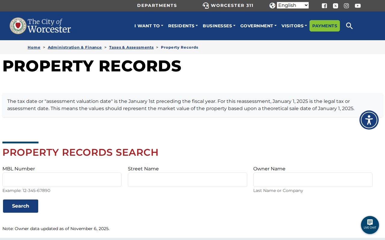
Its three entry fields make it useful for parcel discovery, but the assessment date and city update notice should be retained with any result.
Worcester Situs Address Checks
Two address fields can mean very different things. The situs address identifies the physical Worcester parcel. A mailing address is where tax correspondence goes and may be outside the city, linked to an entity, or used for administrative service. Treating those fields as the same would turn an address record into an unsupported residence claim.
A parcel is a mapped unit of land. A plat or plan is a surveyed drawing that can explain lot boundaries, easements, or a subdivision. A criss-cross directory is a reverse address arrangement, if a repository holds it for the target year. These terms help keep the Worcester street directory trail tied to a source's actual field.
- MBL
- Worcester's map-block-lot parcel identifier.
- Situs
- The physical property address shown for the parcel.
- Plan
- A recorded drawing that can clarify lot form and references.
- Street section
- The address-ordered portion of a historic directory.
Worcester Atlas Parcel Context
The Worcester Atlas is the spatial companion to the assessor form. It is an interactive ArcGIS Experience with city property information and map layers. Use it to orient a parcel, note roads and adjoining geometry, and see whether a corner or rear lot complicates the street sequence. The exact current layer names and popup field order are dynamic, so use the live legend and selected parcel rather than assuming a field is always present.
MassGIS parcel and ZIP downloads offer a statewide cross-check, but they do not replace the city card for current Worcester assessment information. Map geometry also does not tell who occupies a building. It helps determine which record belongs to which piece of land.
When using the live map, preserve the map title and date, visible legend, parcel outline, street names, and any ward or precinct context that is actually displayed. The research confirms the public Atlas but does not claim a fixed list of every live layer, popup field, print control, or export option. That gap is useful: record only what the selected map view truly shows.
Worcester Permit Address Clues
Worcester Permit History adds a separate city record layer. Its form accepts MBL, street name, and an “Issued To” last name or company, and it covers building, electrical, gas, mechanical, plumbing, and temporary permits. The field combination can explain when work was recorded at an address and which permit category appeared in the city system.
The Permit History inquiry is illustrated in the manifest capture.
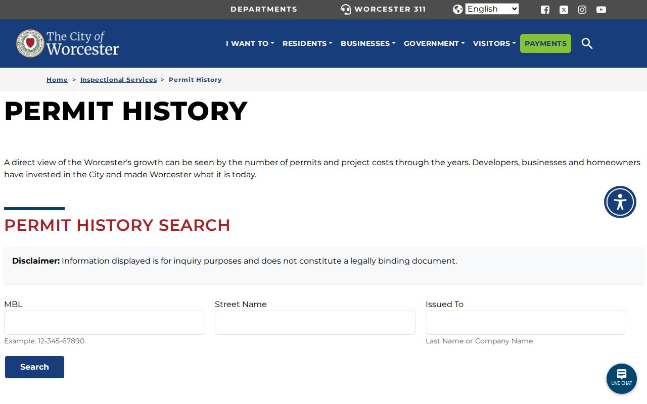
The city calls the output an inquiry only, not a legal document. A permit applicant or issued-to name should therefore be described as an application record, not as an owner or occupant finding. Inspectional Services can answer narrow field questions at 508-799-1198.
For a historical address question, use permit history as one dated layer beside the assessor card, Registry instrument, directory section, and map. Building, electrical, gas, mechanical, plumbing, and temporary permits can add a timeline marker. They do not establish the scope of the work beyond the city inquiry or identify every person connected with the property.
Worcester Street Record Layers
The Worcester street directory combines records that are keyed to an address or parcel. They overlap, but none replaces the others. A deed shows a transfer, a plan shows geometry, a directory supplies a dated street listing, and a ward map supplies civic geography. The table makes the handoff between custodians explicit.
| Worcester record layer | Keeper | What it reports | Access channel |
|---|---|---|---|
| Assessor property card | Worcester Assessing | MBL, owner lead, situs, assessment context | Online; certified inquiry by mail or counter |
| Atlas map | City GIS | Parcel geometry, roads, visible map layers | Public interactive viewer |
| Permit History | Inspectional Services | Permit category, MBL or street, issued-to inquiry | Free online inquiry; office phone or counter |
| Land index and plans | Registry of Deeds | Transfer parties, dates, instruments, plans | MassLandRecords, email, phone, or in person |
| Street directory and maps | WPL, WHM, Clark | Historic number order and address context | Library, museum, database, or archive request |
| Ward and precinct map | Worcester Elections | Civic boundary and polling geography | City or Secretary map |
Worcester Elections can provide public local-file information subject to statutory exclusions, but the public lookup is not a street-by-street presence list. A ward, precinct, and ZIP each describe a different layer of the same location.
Worcester Deed Chain by Address
After identifying the parcel, use the MassLandRecords Worcester portal to look for a property or address record in the appropriate era. The Registry holds records from 1731 to the present. Post-1960 material is substantially fuller for name, book and page, document number, property or street address, city or town, recorded date, and images. A result should be read for document type and party role before it is added to a street history.
Older work changes methods. Before 1960, search the scanned grantor and grantee index books by surname and year range, record the book and page, then use Unindexed Property Search or the scanned image route. A mortgage, release, easement, plan, estate transfer, or foreclosure record can appear between deeds. It may clarify a parcel without being the next ownership transfer.
The Registry's Consumer Notification Service is a separate fraud-prevention feature for an owner who registers up to three properties for email alerts. It is not part of a street directory. If an unexpected instrument appears, preserve the recording date and document number, confirm it with the Registry, and avoid assuming that every filing altered ownership. The Registry also warns about deed and title fraud, which makes document type an essential check.
The Registry at 90 Front Street, Suite C201, can help confirm whether a search belongs in the Worcester or Fitchburg district. Portal searching, image viewing, printing, and downloading are described as free; confirm any certified-copy detail with the Registry.
Worcester Historic Street Sections
For a past Worcester street, the street section of a city directory is the verified reverse path. Worcester Historical Museum and Worcester Public Library hold city, street, house, and specialized directories, while WPL's genealogy databases link directories with census, obituaries, newspapers, and Sanborn maps. The local research did not establish a complete separate criss-cross run, so ask WPL or WHM which street or house directory exists for the target year.
The WPL genealogy databases capture shows the local research route.
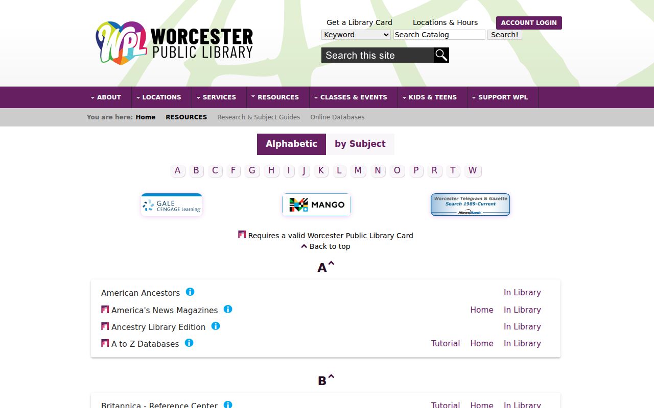
Read both sides of the number sequence where the volume provides it. Note nearby institutions, vacant lots, business entries, spelling, and the printed year. Pair the entry with a map or deed instead of inferring a continuous household history.
Worcester Historical Museum's directory page describes selected scans and directs researchers to ask about unlisted years. WPL's Main Library Local History area holds early-20th-century Worcester directories, and WHM adds house and specialized directories. An older street may also appear in Sanborn maps, Worcester atlases, or Clark map collections. The source year controls the interpretation, especially where a modern ZIP or ward label did not exist.
Worcester Street Geography Comparisons
Worcester streets pass through several overlapping geographies. The Atlas supplies the parcel outline, an Elections map supplies ward and precinct, USPS returns delivery information, and a historic directory uses the publisher's period spelling and number order. A ZIP code is not a neighborhood boundary and does not prove a person is at an address. Nearby Cherry Valley and Paxton references in the 016xx sequence show why postal and municipal labels must be checked separately.
When a number does not match, try the street suffix, nearby numbers, a historic spelling, a corner street, the directory's order, plan references, and the MBL. The research did not locate an official citywide renumbering chronology, so a mismatch should be documented rather than assigned an invented explanation.
Worcester Street Directory Limits
A Worcester street directory can identify public property records, civic geography, recorded transfers, permit inquiries, and dated directory entries. It cannot establish every person's present location, provide protected addresses, or turn an assessor mailing field into a resident record. Confidential voter records, Address Confidentiality Program addresses, impounded court material, protected health-license data, and sensitive identity fields remain outside a public street search.
Lawful use. Use Worcester address records for personal research, family history, civic questions, or an official correction. Do not use public data to stalk, harass, intimidate, or harm anyone.
For retained city material not available through the normal counter or portal, the City RAO process under Massachusetts Public Records Law is the fallback. State what street, date range, and record type are needed, and let the custodian apply the relevant exemptions.